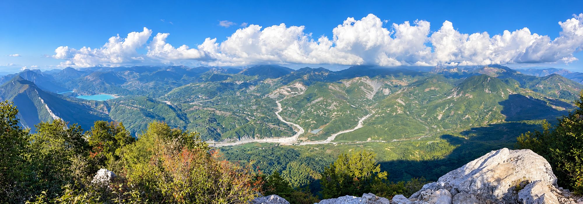
Mount Dajti is the 1,613-meter mountain rising right behind Tirana, and the heart of Dajti National Park. Most visitors ride the Dajti Ekspres cable car up to the plateau at around 1,000 meters for the views; hikers keep going to the summit ridge and the forests beyond.
| Quick facts | |
|---|---|
| Where | East of Tirana; the cable car leaves from Rruga Fadil Deliu (Google Maps) |
| Summit | 1,613 m |
| Getting up | Dajti Ekspres cable car (20 minutes), a winding road by car or taxi, or on foot |
| Price | The park is free; the cable car is about 1,400–1,500 ALL there and back |
| Best time | April to October; winter brings snow on the peaks |
Things to do on Mount Dajti
- Take in the view. From the plateau at the top of the cable car you can see across Tirana, and on clear days all the way to the coast near Durrës.
- Eat with a view. There are restaurants and cafés at the upper station and along the road, many serving grilled lamb and local cheese.
- Adventure park and mini golf at the top, handy if you have kids. There are also shooting ranges and horseback riding opportunities.
- Walk in the beech and pine forest. Even a short walk from the upper station gets you away from the crowds.
Hiking on Mount Dajti
There are marked and unmarked trails across the national park. A popular option is to walk from the upper cable car station up toward the summit ridge and the Tujani peak; another is to hike up from the edge of Tirana and take the cable car back down. Signage is patchy, so download an offline map (such as Wikiloc or Maps.me), carry water and allow more time than you think.
If you choose to do Tujani (Maja e Tujanit, 1,523 meters), bring plenty of water and budget 45 minutes to an hour each way. The trail starts right by the upper cable car station and follows forest tracks along the ridge, climbing gently at first before a steeper final push to the peak. You’ll hike through a beautiful beech and pine forest and enjoy sweeping views of the highlands of central Albania at the top, including Bovilla Lake. Waymarking is sparse, so follow this Wikiloc route from the upper cable car station to Maja e Tujanit on your phone, and skip the rocky summit in fog or after rain, when it gets slippery.
The second classic route climbs from the upper cable car station to the summit of Dajti itself, crowned by the telecommunication antennas you can see from all over Tirana. Budget around 1.5 to 2 hours each way for the roughly 550 meters of ascent: the route mixes a gravel service road with steeper forest paths, and the last stretch is open and exposed to sun and wind. From the top you get the classic view straight down over Tirana, with the Adriatic coast visible on clear days. The antenna compound itself is fenced off, so don’t try to enter it, and use this Wikiloc track to the Dajti summit and Tujan to navigate; it also shows how to link both peaks into one longer day.
Tips
- It’s noticeably colder than the city, so bring a layer.
- Weather turns fast. Check the forecast and don’t start a long hike in the afternoon.
- Combine the trip with Bunk’Art 1, next to the cable car’s lower station.
FAQ
How high is Mount Dajti?
Mount Dajti is 1,613 meters high.
Can you hike Mount Dajti from Tirana?
Yes. Trails start from the eastern edge of the city, and many hikers walk from the cable car station and take the cable car down.
Is Dajti National Park free?
Yes, entry to the national park is free.